It has become abundantly clear that I’m not going to catch up with my blog posts from all we’ve done in the past 6 months. I definitely wanted to do a nice, long write-up for each stop, and there would be plenty to fill up those posts; however, in the interest of bringing the blog back up to date, I’m going to do a few catch-up posts to breeze through all we’ve done since my last update. My hope is that I can pick back up in the present and keep it more closely aligned with our travels as we move through Alaska.
Grand Teton National Park
We left Idaho and headed to Grand Teton National Park in Wyoming. We skipped over Yellowstone, arguably one of the most impressive National Parks in the system, but we’d both visited before, and we didn’t have time to really see both parks, so we opted to spend our time in the Tetons.

A relief map of Grand Teton National Park
Grand Teton National Park was pretty close to the top thing I wanted to visit in our first year on the road (taking 2nd place only to Alaska). I visited once before, over 10 years ago, but only spent a day in the park. I’ve wanted to come back ever since. The Teton Mountain Range are some of the most stunning, impressive mountains I’ve ever seen. The highest peak in the range, Grand Teton, is only 13,775’ tall. It’s big, but it’s only the 78th highest peak in North America. What makes the mountain range so impressive is the lack of foothills blocking the view. You can see all the way from the base of the mountains to the peaks over a mile above. Combine that with the Snake River, Jackson and Jenny Lakes, and the colorful trees, and it’s a sight to behold. Also, fun fact - the french named the range les trois tétons, aka “the three nipples”, so jokes about tetons and breasts are completely appropriate.

View of the Snake River and the Cathedral Group of the Teton Mountain Range. It is very close to the location where Ansel Adams took his famous shot of the park.

Grand Teton standing in stark relief with the surrounding valley.

A panorama of the Teton mountain range.

LSP posing with the Tetons in the distance.
Neither of us had ever seen a moose in the wild (at least that we could remember), so it was high on our list of wildlife we wanted to see on the trip. On our first day at the park, we went searching. We asked the rangers, and they had some suggestions, but we didn’t see anything. We were on our way home for the day and decided to stop at one overlook again. There were no moose, but while there, we saw a guy with a professional camera and started chatting about photos and travel. After chatting a bit, we told him we were looking for moose but having no luck, and he says, “oh, well if you want to see some right now, just drive to the Gros Ventre Campground down the road. I was just there taking pictures.” We followed his advice, and it was even better than expected!
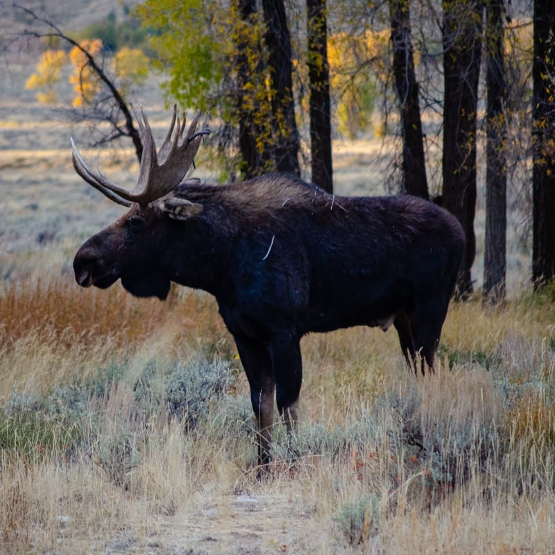
Moose!
There were four total - three cows and one bull - sitting right by the road. A pretty good crowd had gathered to watch. People seemed to be a bit closer than recommended, but the moose didn’t seem to mind us. I took about 10000 pictures. Eventually, the bull did start walking toward the crowd, and we backed up quite a bit, worried about a charge, but he just walked past everyone and wandered off into the campground.

Moose!

Sushila observing from the safety of Mr. Trucky.
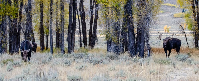
The bull and his ladies.

Observers getting a bit too close for comfort.

The bull moose wandering through the nearby campground.
If you want to see wildlife, find the photographers and ask them!
We heard Cascade Canyon was one of the most scenic hikes in Grand Teton National Park, and we also heard it was a great place to see wildlife, so we had to go! The trail starts after a ferry ride across Jenny Lake, and it goes through the canyon along side the Cathedral Group peaks of the Teton range.

View of the canyon across Jenny Lake.

My favorite shot from this park.
The hike was absolutely beautiful! We hadn’t planned it, but we ended up there at the perfect time to see the fall colors. Hiking on a beautiful clear day through the brightly-colored aspen and dark-green pine while the mountain peaks rise more than a mile above the trail next to you was amazing.
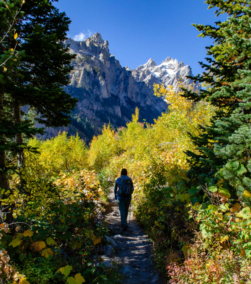
Sushila hiking along the trail.
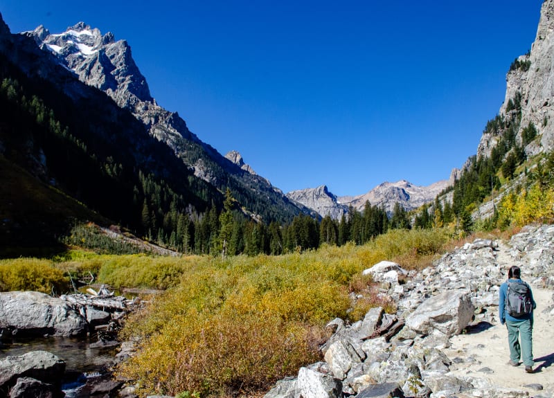
Sushila hiking along the trail.

Waterfall along the trail.
We got super lucky and also saw a bear on the hike. It was probably a hundred yards away and out across a stream, so we didn’t feel unsafe at all, and we didn’t bother the bear. It was a clear view, though, and we got to watch the bear walk along the water for quite a while. It was a great experience!

A bear!
To top off the hike, we saw a number of Pika running through the rocks, another first for us, and we also saw another moose! This one was off in the brush and hard to see, bit it was still pretty awesome.

A Pika!
Colorado
We left Grand Teton National Park and headed toward Denver, Colorado. My brother Jesse and his girlfriend, Rachel, moved to the area earlier in the summer, so we wanted to spend some time with them and explore the area a bit. We also timed the stop to overlap with my parents visiting.

View of the front range of the Rocky Mountains from behind my brother’s apartment
A must-see spot in the area was Rocky Mountain National Park. We arrived near the end of the peak season, and it ended up being the last day that Trail Ridge Road (which runs across the park and over some very high mountain passes) was open. A storm was forecast to hit later in the day, so we opted to skip the mountain roads and explore the eastern half of the park

Fall colors in the trees

Brightly colored leaves along a path
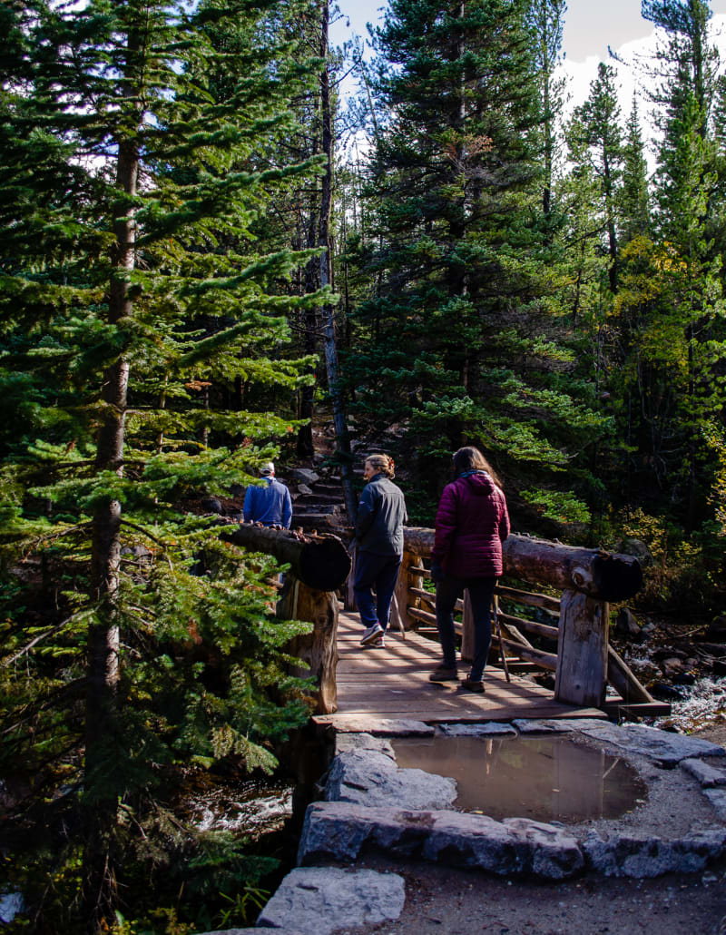
Hiking through the forest

The hike ended at a waterfall!
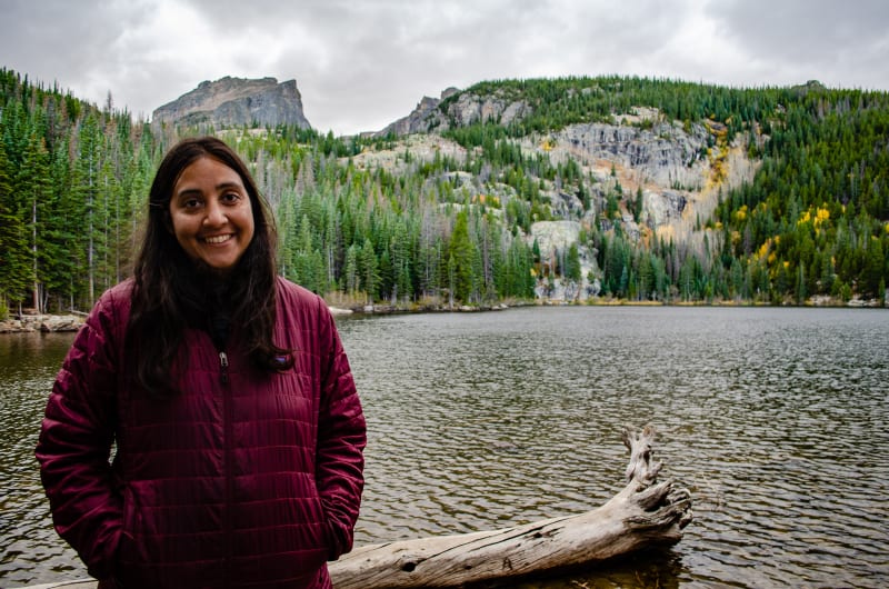
Sushila at Bear Lake
The highlight of the day, though, was the Elk. Elk can be seen in the park all year round, but in the fall, they come out of the alpine zones and into the meadows. We were able to see them in both Horseshoe Park and Upper Beaver Meadows. Not only did we get to see large herds, but since it’s mating season, we heard a lot of bugling and even saw some fighting among the bulls!

Looking across West Horseshoe Park

A male elk bugling

So many elk!

Two bull elk fighting
Before leaving the Denver area, we also visited Red Rocks Amphitheatre, saw a huge wall of dinosaur tracks, hiked, biked, and tried many of the area’s breweries. Three weeks was not enough time for everything, but we thoroughly enjoyed our time with family, and we needed to continue south.
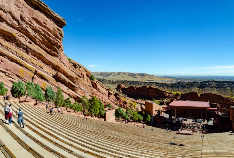
Red Rocks Amphitheatre with Denver in the background

A model of the amphitheatre

Dinosaur tracks!

The underside of a large dinosaur track
Our last stop in Colorado was Great Sand Dunes National Park. You don’t really expect sand dunes in Colorado. Along the beach? Sure. In a south-western desert? Definitely. In a valley in the Rocky Mountains with 14,000’ peaks around them? Not so much. But there they are! The right combination of geology, geography, and weather caused the sand to collect at the foot of the Sangre de Cristo mountains and form the tallest dunes in North America. I knew Great Sand Dunes National Park existed, but I didn’t actually know where until I was researching the leg of our trip from Denver to Texas. I was browsing a map for things to see along the way, and hey, look, there’s a National Park!
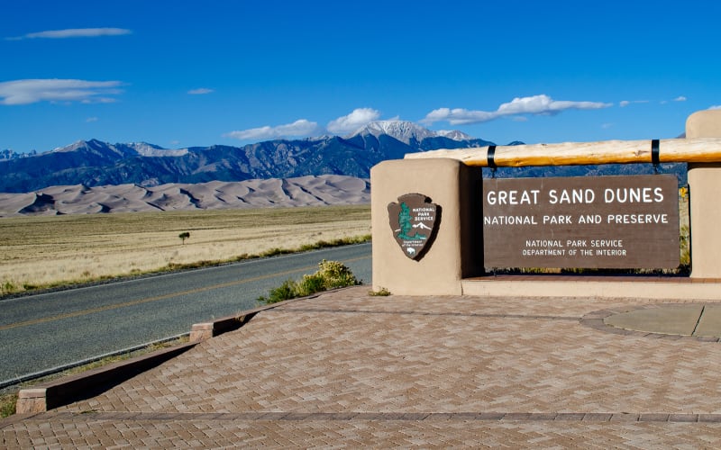
Great Sand Dunes National Park

Panorama of the dunes
It’s hard to get a sense of scale from the pictures. They look small, especially with the mountains in the background. But once you get out and climb them, you really start to feel it. Climbing up 700+ feet of sand is no joke. When you get to the top, look back, and realize you can barely see the people at the bottom, the dunes feel enormous. Then you look out across the rest of the dune field, and it’s almost hard to believe.

Sushila looking out at the dunes.

Climbing the dunes
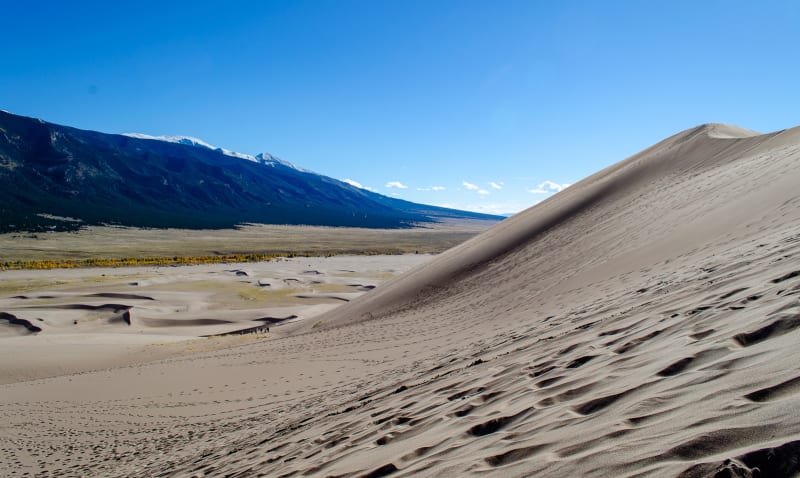
View along the dunes

Nearing the top

Hiking the final ridge at the top of the dunes

The view from the top out across the rest of the dunes
My favorite thing about the park was that the dunes felt like a big playground. There aren’t any defined trails, and you can go wherever you want. Kids played with toys and rolled down the slopes. People were running down and jumping off the ridges. You can rent sleds and sand boards to ride down the dunes. I’m actually not a big fan of sand, and when I saw people running down through the dunes, I just thought about how covered in sand and uncomfortable they must be. But eventually, I tried it anyway, and it was awesome. The feeling of running down the sand, sinking and sliding with each step, was great. You really have to try it.

Panorama of the dunes with many tracks running down the hills
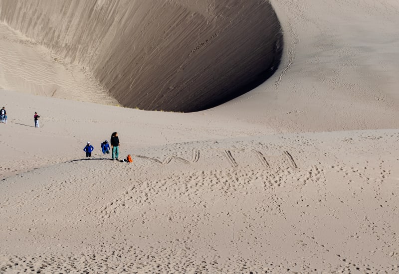
Having fun in the sand
Due to the weather, we didn’t end up camping very close to the park, but if you do, you are allowed in the park at night, too. I’ve been told that sledding the dunes at night is a wonderful experience, so I’m passing along that suggestion.
Texas
Panhandle
Our first stop in Texas was the tiny town of Wellington, located in the panhandle. We were there for NomadFest, a large gathering of RVers. The event was organized around the premiere of the “RV Nomads” movie which follows the lives of full-time RVers and aims to educate people about the lifestyle. In addition to the movie, there were seminars and social activities. It was our first large-scale RV meetup, and we had a great time.

RV Nomads showed in the town’s theatre.

The cast and crew after the movie premiere

The Status Crowes featuring Drivin’ and Vibin’ and Audrey Callahan
After NomadFest, we stuck around the Texas panhandle to explore the area a bit more. We camped along Lake Meredith which was a really impressive spot for being free camping. The sites were well maintained, and the view was spectacular. The majority of the sites are right along a cliff leading down to the water’s edge. If you fish or have a boat, it’s the perfect place for that. We opted for a nice hike along the cliffs. The sunsets were definitely our favorite part, though.
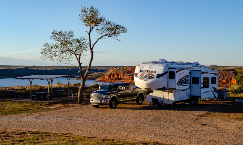
Our campsite along Lake Meredith

A view of Lake Meredith from our hike

Stopping for a picnic lunch while out on a hike

Watching sunset from the campground
We visited Alibates Flint Quarries National Monument which protects flint quarries used by some of the earliest peoples on the continent. To prevent people from taking the flint, the only way to enter the area and view the quarries is on a guided tour. If you really want a piece, though, ask your guide. While they are not allowed to sell (or give away) any flint from the National Monument, some local landowners in the area that also have some of the flint have donated it to the park to be given to guests. We got lucky and were able to bring some home.

A piece of Alibates flint
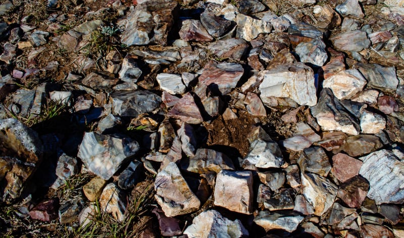
A bunch of flint scattered around the ground
We also visited Palo Duro Canyon State Park. It is the second largest canyon in the United States after the Grand Canyon. It’s 120 miles long, 20 miles wide, and 800 feet deep (compared to 277 miles, 18 miles, and 6000 feet for the Grand Canyon). It was formed when the Red River cut through the cliffs separating the high plains from the surrounding terrain.

A panoramic view of the canyon

The canyon has many interesting rock formations
The canyon is filled with mixed-use trails, and we’ve been eager to get out and ride again since leaving Colorado, so we opted for biking the canyon. We rode the majority of the park loop road, and we also rode our first real mountain biking trail (a very easy one). There were some tough sections (for us), but we made it through and had a great time!
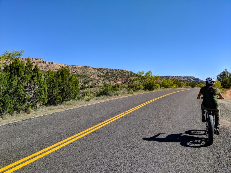
Biking along the park loop road

The mountain biking trail that we rode
The visitor facilities at the canyon are also well suited to sunset pictures. There are many east-facing overlooks, and the golden light hitting the canyon walls was pretty amazing.

Watching the sunset from the rim

Another shot of sunset at Palo Duro Canyon
Hill Country
Next up was Texas Hill Country, located in central texas near Austin and San Antonio. It was a pretty stark difference from the panhandle. There are hills and plants and water and people. We spent the first half of our time here in Austin at McKinney Falls State Park. It’s a beautiful park that’s just minutes from downtown, but it feels a world apart. It’s located at the confluence of the Onion and Williamson Creeks which carve through the limestone rock in the area, forming two waterfalls and some great, natural swimming holes. It was a bit too cold to swim while we stayed in the park, but it looks like a great spot to be in the summer.

McKinney Falls
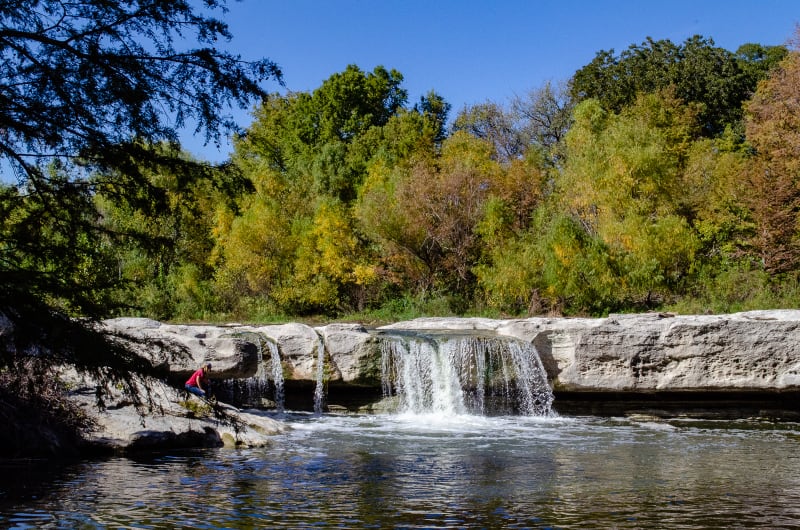
McKinney Falls
Austin itself was a lot of fun. The traffic is as crazy as advertised, but we got over it. I got to visit a proper cocktail bar again - my first since leaving NYC. We watched a movie at the Alamo Draft House. We walked around on 6th street. We ate at food trucks. We visited Barton Springs and kayaked on Lady Bird Lake. We took in the city skyline from Butler Park, and we drank lots of delicious local beer (Jester King was my favorite). I can definitely understand why so many people want to be in the area.

Whisler’s cocktail bar. They also had a Mezcal bar upstairs!

Barton Springs

Kayaking on Lady Bird Lake
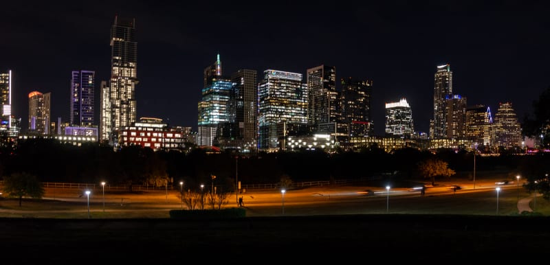
The Austin skyline from Butler Park
We also spent some time exploring actual Hill Country outside of the city. We swam at Hamilton Pool Preserve, a natural pool that was formed when the dome of an underground river collapsed. Now, the Hamilton Creek pours over the limestone outcropping and falls 50’ into the pool below. It was incredible. The falls. The turquoise water. The colorful leaves. The moss and plants growing all over the rocks. It was picturesque. They restrict the number of visitors each day, so it wasn’t too crowded, and because of all the recent rain, the falls were flowing more than normal. The water was a bit cold, but on a hot sunny day, it was refreshing.

Enjoying the water at Hamilton Pool Preserve

Hamilton Pool Preserve
We also made a trip to Pedernales Falls State Park to hike around the rocks and see all of the falls. It wasn’t quite swimming weather when we visited, but we still really enjoyed it.
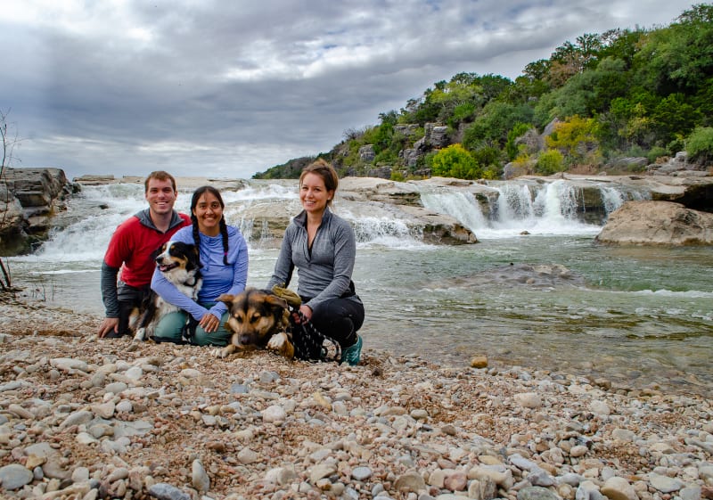
We explored the park with Cassie and Jasper!
After leaving Austin, we traveled about an hour south and spent two weeks camping at Mystic Quarry near Canyon Lake, Texas. Canyon Lake was formed when the Guadalupe River was dammed in 1964, and it serves as both a water reservoir and a method of flood control.
In 2002, the area received 34” of rain in one week, causing Canyon Lake to overflow the emergency spillway for the first time. At its peak, water flowed at 67,000 cubic feet per second, compared with a normal flow of 350 cfs. Water continued to flow through the spillway for over 6 weeks, eroding away all of the topsoil and sediment that filled the valley below. When the flooding finally stopped, a 64 acre gorge was revealed.

Layers of rock exposed by the flood waters

The start of the newly formed gorge

Hiking along the gorge
The gorge exposes 100 million year old limestone from a time when the area was covered by a shallow sea, and many marine fossils and dinosaur tracks are present. The gorge is also filled with waterfalls and springs. The area is now protected by the Gorge Preservation Society, and the only way to explore the canyon is by a guided tour with the group. The tour is 3 hours long and is lead by a geologist who explains the details of the rock layers and the geology of the area.

A small waterfall in the gorge

The gorge was filled with fossils

Another fossil in the rocks
It was a wonderful tour, and we highly recommend it for anyone visiting the area (an hour north of San Antonio, 20 mins west of New Braunfels and San Marcos). The geology is fascinating, and even if you don’t find rocks all that interesting, it’s still a beautiful hike through the gorge.
Finally, we made a trip into San Antonio to visit the Alamo and the San Antonio Riverwalk. Both seemed like must-see things in the Hill Country area, so we didn’t want to miss them. We weren’t overly impressed with the Alamo. The historic chapel was neat to see, and I’d definitely suggest a stop if you’re already in the area. I wouldn’t recommend a stop just for that, though.

The chapel at the Alamo mission
The riverwalk, on the other hand, was surprisingly cool. San Antonio did a fantastic job creating a walking path along the Guadalupe River as it snakes through town. I really hoped for nice weather so we could sit outside along the water and eat, but of course it was freezing cold on the only day we had available to visit. We still really enjoyed it, though. It’s definitely touristy, which we expected, but it was done well and didn’t feel nearly as ridiculous as somewhere like Niagara Falls or Mt. Rushmore. West Texas

The riverwalk in San Antonio

The riverwalk in San Antonio
After nearly a month in hill country, it was time to get moving. We stopped in Midland, Texas, to visit Sushila’s grandmother and enjoy Thanksgiving with her family. We had a great time with the family, but Midland is very much the West Texas you imagine, where everything is a shade of brown and oil derricks are more common than trees. It was also the only part of West Texas I’d ever visited prior to this trip, and I sort of assumed the rest was more or less the same. I was very wrong.
Up Next
Our next “Catch Up” post will cover our time in West Texas, New Mexico, Arizona, and Mexico!
